
MULTIVISION V3 COMIN SOON
MULTIVISION V3 COMIN SOON
FISHING FORTUNE MULTIVISION V3 — COMING SOON
MULTIVISION V3 is the next-generation fish-finding and underwater mapping system from Fishing Fortune, developed as part of the ETERNITY ecosystem. Built specifically for bait boats, MULTIVISION V3 combines real-time 200 kHz sonar, bathymetry, GPS mapping, 3D underwater visualisation and advanced target marking in one connected platform. The system is designed to work with both ETERNITY PILOT BASIC and ETERNITY PILOT PRO, allowing the sonar, navigation and mapping functions to become part of the same Fishing Fortune interface.200 kHz SONAR
The main MULTIVISION V3 sonar is a dedicated 200 kHz sonar system designed for real-time depth and underwater target detection. Key functions include:- Real-time echogram
- 200 kHz sonar
- A-Scope
- Automatic and manual depth range
- Intelligent Auto Depth
- Adjustable sensitivity
- Multiple colour palettes
- Fish and underwater target detection
- Bottom structure visualisation
- Water depth information
- Sonar recording and playback
- GPS-linked sonar data
BATHYMETRY
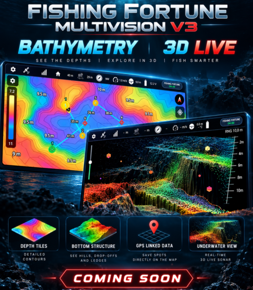
MULTIVISION V3 is designed to create bathymetric maps from real sonar and GPS data collected by the boat. As the bait boat moves across the water, depth measurements can be combined with GPS position to build a detailed representation of the lake or fishing area. Bathymetry features are planned to include:- Live depth mapping
- Depth-coloured bathymetric tiles
- Bottom contour visualisation
- GPS-linked
- Previously scanned area display
- Saved fishing areas and routes
- Reusable bathymetry data for future sessions
3D LIVE
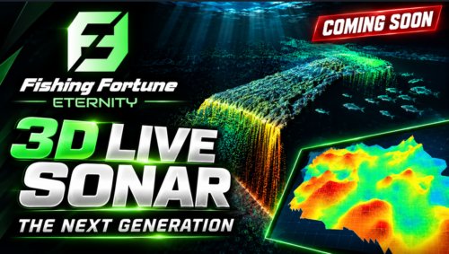
3D LIVE takes sonar, GPS and boat movement data and turns it into a three-dimensional underwater view. Instead of viewing only a traditional scrolling echogram, the user can explore the underwater area spatially and see how detected structure relates to the boat position and surrounding bottom. Planned 3D LIVE capabilities include:- 3D bottom visualisation
- Real-time depth representation
- Underwater structure display
- Fish and target positioning
- GPS-linked 3D data
- Boat position and movement
- Previously scanned area
- Live interaction with the underwater model
DOWN SCAN & SIDE SCAN
DOWN SCAN and SIDE SCAN are separate from the main 200 kHz SONAR. They will use a dedicated additional transducer/sensor system designed specifically for higher-detail underwater imaging.DOWN SCAN
Designed for a more detailed view directly beneath the bait boat. Useful for:- Bottom detail
- Structure identification
- Vegetation
- Branches and submerged objects
- Fish close to structure
- More detailed separation of underwater targets
SIDE SCAN
Designed to scan a wider area to both sides of the bait boat. Useful for:- Searching large areas
- Finding underwater structure away from the boat
- Detecting channels and drop-offs
- Locating submerged objects
- Identifying productive fishing areas without driving directly over them
SAVE SPOTS FROM ANY UNDERWATER VIEW
One of the key ideas behind MULTIVISION V3 is that the user should not need to switch back to the map every time something interesting is found. A fishing spot can be created directly from: SONAR ECHOGRAM 3D LIVE BATHYMETRY TILES MAP The selected location is stored with GPS coordinates and can later be used for:- Navigation
- Autopilot routes
- Returning to a fishing location
- Bait placement
- Repeated scanning
- Building a personal map of productive areas
ETERNITY PILOT BASIC
MULTIVISION V3 will integrate with ETERNITY PILOT BASIC to provide a complete sonar and navigation system without requiring the full PRO hardware package. Planned BASIC integration includes:- 200 kHz SONAR
- Real-time echogram
- Depth
- A-Scope
- Fish and target detection
- GPS map
- Bathymetry
- Saved spots
- Routes
- Autopilot integration
- Mobile device interface
- Sonar recording
- GPS-linked sonar data
ETERNITY PILOT PRO
ETERNITY PILOT PRO expands the system further. In addition to BASIC functionality, the PRO platform is designed to support:- DOWN SCAN
- SIDE SCAN
- Advanced sensor integration
- 3D LIVE
- Extended bathymetry
- Camera systems
- Front camera
- Rear camera
- Underwater cameras
- Camera movement mechanisms
- Additional Fishing Fortune modules
- Extended wireless communication options