ETERNITY PILOT PRO
Advanced Bait Boat Autopilot, Sonar, Mapping & Control Platform
ETERNITY PILOT PRO is the flagship control platform of the
Fishing Fortune ETERNITY ecosystem.
It is being developed as much more than a conventional bait boat autopilot. PILOT PRO brings together
precision navigation, configurable boat control, sonar, live bathymetry, 3D underwater mapping, cameras, voice control, modular accessories and multi-band communications within one integrated system.
At the centre of the PRO platform is a
dedicated Fishing Fortune controller developed specifically for ETERNITY.
DEDICATED ETERNITY PILOT PRO CONTROLLER
Unlike PILOT BASIC, which is designed around smartphone operation,
PILOT PRO uses its own dedicated Fishing Fortune controller.
The controller is being designed specifically around the requirements of bait boats rather than adapting a generic RC transmitter.
Planned functions include:
- Integrated display
- Physical joystick control
- Touchscreen interface
- Dedicated boat-function controls
- Navigation and map display
- Sonar display
- Bathymetry
- 3D LIVE
- Camera display
- Routes and waypoints
- Saved fishing spots
- Full-screen operation
- Split-screen operation
- Voice control
- Spoken system feedback
- Configurable interface
- Online software and firmware updates
The objective is to provide physical control when required while retaining a modern touchscreen interface for navigation, sonar and advanced functions.
ADVANCED AUTOPILOT
ETERNITY PILOT PRO is designed to automate both navigation and bait-boat operations.
Core navigation functions include:
- Manual control
- Autopilot navigation
- Go Home
- Navigate to saved spot
- Multi-waypoint routes
- Route creation
- Route editing
- Route saving
- Repeatable routes
- Boat position
- Heading
- Speed
- Distance to target
- Distance to Home
- GPS status
- Radio-link information
- Battery information
The system is intended to allow the user to create complete fishing missions rather than simply driving from point A to point B.
FULLY PROGRAMMABLE WAYPOINTS
A waypoint in ETERNITY PILOT PRO is not simply a GPS coordinate.
Every waypoint can be configured individually.
A waypoint can define both navigation behaviour and boat actions.
Possible waypoint parameters can include:
- GPS position
- Arrival radius
- Boat speed
- Stop at point
- Wait for a defined time
- Continue automatically
- Open Left Hopper
- Open Right Hopper
- Activate Spreader
- Release Hook
- Switch lights
- Change RGB lighting
- Trigger auxiliary channel
- Trigger servo mechanism
- Start sonar recording
- Stop sonar recording
- Execute supported camera action
- Continue to next waypoint
- Return Home
A programmed route could therefore operate like this:
HOME
 ↓
WAYPOINT 1
Navigate at selected speed
 ↓
WAYPOINT 2
Stop
Open Left Hopper
Wait 5 seconds
 ↓
WAYPOINT 3
Slow scan
Record sonar
 ↓
WAYPOINT 4
Open Right Hopper
 ↓
WAYPOINT 5
Release Hook
 ↓
RETURN HOME
This allows ETERNITY PILOT PRO to automate an entire bait-placement sequence.
AREA SCANNING
PILOT PRO is designed to work together with
MULTIVISION V3 for systematic underwater scanning.
Instead of manually driving randomly across an area, the user can create a survey pattern.
For example:
→ → → → → →
← ← ← ← ← ←
→ → → → → →
← ← ← ← ← ←
The boat follows parallel scan lines while sonar and GPS data are collected.
This can be used to identify:
- Drop-offs
- Channels
- Plateaus
- Shelves
- Underwater structure
- Depth transitions
- Potential fish-holding areas
- Previously unknown bottom features
The collected data can then be converted into bathymetric information and saved for later fishing sessions.
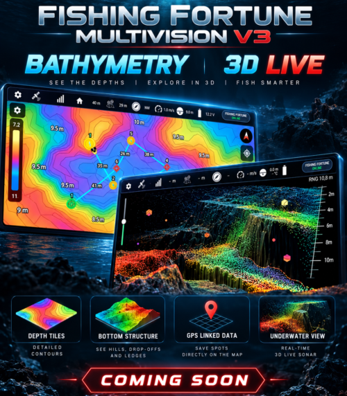
LIVE BATHYMETRY
With MULTIVISION V3 connected,
ETERNITY PILOT PRO can build bathymetric maps from real measurements collected by the user's own boat.
GPS position and sonar depth information are combined while the boat moves.
Planned bathymetry functions include:
- Live bathymetric scanning
- GPS-linked depth measurements
- Colour-coded depth tiles
- Bottom contours
- Shallow/deep visualisation
- Scanned-area history
- Previously surveyed areas
- Repeated scans
- Bathymetry saved for future sessions
- Integration with routes
- Integration with fishing spots
- 2D and 3D underwater representation
Rather than relying only on existing map information, the angler can progressively create a
personal underwater map of the fishing venue.
SAVE SPOTS DIRECTLY FROM UNDERWATER DATA
One of the core ETERNITY concepts is that interesting underwater features can immediately become navigation targets.
A
SPOT can be created directly from:
- Standard map
- 200 kHz sonar echogram
- Bathymetry tiles
- 3D LIVE
- Scanned underwater structure
For example:
See a drop-off on the bathymetric map:
Tap → SAVE SPOT
See an interesting return on the echogram:
Tap → SAVE SPOT
Find a structure in 3D LIVE:
Select → SAVE SPOT
The GPS location becomes available to the autopilot for later navigation.
This allows the complete workflow:
SCAN → FIND → SAVE → RETURN
without manually transferring coordinates between different systems.
MULTIVISION V3 INTEGRATION
ETERNITY PILOT PRO is designed for full integration with the
Fishing Fortune MULTIVISION V3 sonar platform.
200 kHz SONAR
The standard MULTIVISION V3 sonar provides:
- Real-time echogram
- 200 kHz sonar
- A-Scope
- Depth
- Automatic depth range
- Manual depth range
- Auto Depth
- Adjustable sensitivity
- Multiple colour palettes
- Fish and target detection
- Bottom structure
- GPS-linked sonar data
- Sonar recording and playback
The 200 kHz sonar is the main conventional sonar mode.
DOWN SCAN
DOWN SCAN is planned as an additional imaging mode using a separate dedicated transducer/sensor system.
It can provide a more detailed representation directly beneath the bait boat.
Useful for:
- Bottom structure
- Vegetation
- Branches
- Submerged objects
- Structure separation
- Fish close to structure
- Detailed underwater features
SIDE SCAN
SIDE SCAN will also use a dedicated additional transducer/sensor system.
It is intended to scan a wider underwater area to either side of the bait boat.
Possible uses include:
- Searching large areas
- Detecting structure away from the boat
- Finding underwater channels
- Finding drop-offs
- Locating submerged objects
- Surveying areas without travelling directly over every feature
3D LIVE
3D LIVE combines sonar data, GPS positioning and boat movement to create a spatial representation of the underwater environment.
Planned functions include:
- 3D bottom representation
- Live boat position
- Depth information
- Underwater structure
- Target positioning
- Previously scanned areas
- GPS-linked underwater data
- Interactive 3D navigation
- Direct SPOT creation from the 3D view
The user can inspect an underwater feature and immediately save it as a future navigation point.
ONLINE & OFFLINE MAPPING
Standard maps, downloadable offline maps, online satellite imagery, bathymetry and 3D underwater mapping — all within the same navigation system.
MODULAR GPS / GNSS
ETERNITY PILOT PRO is being designed around a
modular GNSS architecture.
Different compatible positioning modules can be used depending on the required level of performance.
Supported configurations are planned to include:
- Standard GPS/GNSS
- Multi-constellation GNSS
- Higher-performance GNSS receivers
- RTK-ready GNSS modules
This allows the system to evolve without requiring an entirely new autopilot board.
RTK-READY POSITIONING
With a compatible RTK GNSS module and correction source, ETERNITY PILOT can support much more precise positioning than conventional standalone GNSS.
Potential applications include:
- Returning to a precise bait location
- Returning to previously scanned underwater structure
- Repeating survey lines
- Precise waypoint navigation
- Repeating a route during a later fishing session
- Accurate bathymetric positioning
RTK operation depends on the installed GNSS hardware and availability of suitable correction data.
BUILT-IN ODOMETER
The PILOT system includes its own odometer functionality.
Planned information includes:
- Current trip distance
- Fishing-session distance
- Route distance
- Total boat distance
- Lifetime travelled distance
- Usage statistics
The odometer is maintained by the PILOT itself rather than depending solely on the mobile device or controller.
16 CONFIGURABLE CONTROL CHANNELS
ETERNITY PILOT PRO is designed around an expandable
16-channel architecture.
These channels can be assigned according to the hardware installed in the individual bait boat.
Possible assignments include:
- Left Hopper
- Right Hopper
- Hook Release
- Spreader
- Main Lights
- Navigation Lights
- RGB Lighting
- Front Camera
- Rear Camera
- Underwater Camera
- Second Underwater Camera
- Camera Pan
- Camera Tilt
- Camera Rotation
- Additional Servo
- Custom Accessory
The same autopilot can therefore be configured for a simple two-hopper boat or a highly customised multi-function bait boat.
CUSTOM BOAT INTERFACE
One of the most distinctive ETERNITY PILOT features is the ability to build a control interface around the
user's actual boat.
The user can upload a photo or image of their own bait boat.
That image can then become an interactive control panel.
For example:
           FRONT LIGHT

     CAMERA        CAMERA

 HOPPER L          HOPPER R

    HOOK          SPREADER

             RGB
Buttons can be positioned directly over the corresponding parts of the photograph.
the user simply taps the relevant part of their own boat.
CUSTOM CONTROLS
The interface can be configured according to the installed accessories.
The user can assign:
- Function
- Button position
- Button name
- Channel
- Icon
- Control type
- Momentary action
- Toggle action
- Servo movement
- Camera movement
- RGB function
This makes the same app/controller suitable for many different bait-boat layouts.
RGB LIGHTING CONTROL
ETERNITY PILOT PRO can support integrated RGB lighting control.
Functions can include:
- Colour selection
- Brightness
- Presets
- Navigation colours
- Status indication
- Custom lighting modes
- Channel-controlled lighting
- Waypoint-triggered lighting actions
RGB functions can also appear directly on the custom boat image.
CAMERA SYSTEM
PILOT PRO is designed for extensive camera integration.
Depending on installed hardware, the system can support:
- Front camera
- Rear camera
- Underwater camera
- Second underwater camera
- Camera switching
- Camera power
- Camera recording
- Live camera view
- Pan
- Tilt
- Rotation
- Underwater camera movement mechanism
- Camera deployment/retraction mechanism
- Additional servo-controlled camera hardware
Camera-control commands require very little bandwidth and remain part of the PILOT control system.
MULTI-BAND COMMUNICATION
The full ETERNITY architecture is designed around multiple communication layers.
SUB-GHz
Intended for:
- Long-range control
- Critical commands
- Telemetry
- Failsafe communication
2.4 GHz
Intended for:
- Higher-speed data
- Sonar communication
- Additional telemetry/data functions
5 GHz — OPTIONAL
Intended for:
- Camera video
- Multiple camera streams
- High-bandwidth IP data
The exact frequencies and transmit power available will depend on the regulatory region.
REGIONAL RADIO PROFILES
ETERNITY PILOT is planned to use regional radio profiles rather than allowing unrestricted RF settings.
A selected or automatically determined region can configure:
- Allowed frequencies
- Transmit power
- Channel bandwidth
- Permitted radio modes
- Duty-cycle requirements
- Spectrum-access requirements
This allows the same hardware platform to support different markets while keeping the radio configuration within the permitted regional profile.
VOICE CONTROL
ETERNITY PILOT PRO is planned to support optional
voice control.
Possible commands include:
- Go Home
- Start Autopilot
- Stop Autopilot
- Start Route
- Pause Route
- Navigate to Spot
- Save Spot
- Open Left Hopper
- Open Right Hopper
- Activate Spreader
- Release Hook
- Lights On
- Lights Off
- Change RGB Colour
- Start Sonar Recording
- Show Sonar
- Show Map
- Show 3D LIVE
- Switch Camera
- Camera Left
- Camera Right
- Camera Up
- Camera Down
Custom voice phrases can also be mapped to configurable functions.
VOICE CONFIRMATION
For significant actions, confirmation can be required.
For example:
User: “Go Home.”
PILOT: “Confirm Go Home?”
User: “Confirm.”
The command is then transmitted to the boat.
This reduces the chance of accidental execution of critical actions.
SPOKEN SYSTEM FEEDBACK
ETERNITY PILOT PRO can also provide optional spoken status information.
Examples include:
- “Autopilot engaged.”
- “Autopilot stopped.”
- “Waypoint reached.”
- “Route completed.”
- “Returning Home.”
- “Home reached.”
- “Left Hopper opened.”
- “Right Hopper opened.”
- “Spot saved.”
- “Sonar recording started.”
- “Low battery.”
- “Weak signal.”
- “GPS signal lost.”
- “RTK fixed.”
- “RTK float.”
- “MULTIVISION connected.”
- “Camera connected.”
- “Connection restored.”
Users can select the amount of spoken information:
OFF
ESSENTIAL
NORMAL
FULL
SPLIT SCREEN
The PILOT PRO interface is designed to display multiple functions at once.
Examples include:
MAP + SONAR
MAP + 3D LIVE
BATHYMETRY + SONAR
CAMERA + MAP
CAMERA + SONAR
A long press on another compatible mode can divide the display and open that mode alongside the current one.
FULL-SCREEN MODE
Any major information view can also occupy the entire screen:
- Map
- Sonar
- Bathymetry
- 3D LIVE
- Camera
- Routes
This provides maximum visibility when detailed information is more important than simultaneous controls.
MODULAR EXPANSION
ETERNITY PILOT PRO is intended to support additional modules as the ecosystem grows.
Potential modules include:
- Additional servo controllers
- Additional I/O
- RGB controllers
- Camera modules
- Camera mechanisms
- Sensor modules
- Alternative GNSS modules
- RTK modules
- Future Fishing Fortune hardware
This allows new functionality to be added without replacing the entire core autopilot.
ONLINE UPDATES
The ETERNITY platform is designed to continue evolving after purchase.
Supported hardware can receive online updates when an internet connection is available.
Updates can provide:
- Autopilot improvements
- New functions
- New accessory support
- New ETERNITY modules
- New sonar functionality
- Navigation improvements
- Interface improvements
- Regional radio-profile updates
- Firmware fixes
- Performance improvements
ONLINE & OFFLINE MAPS
ETERNITY PILOT PRO is designed to work both online and completely offline.
Navigation, saved spots and autopilot functions should not depend on having a mobile-data connection at the fishing venue.
OFFLINE MAPS
Users will be able to download maps in advance and keep them directly on the phone or ETERNITY PILOT PRO controller.
Offline mapping can provide:
- Downloadable map regions
- Country and regional map packages
- Maps available without mobile signal
- Multiple installed offline maps
- Activate or deactivate installed maps
- Delete and manage downloaded map packages
- Support for compatible locally stored map files
- GPS boat position
- Saved fishing spots
- Routes and waypoints
- Autopilot navigation
- Bathymetry overlays
- Previously scanned areas
Once a map has been downloaded, the main navigation system can continue working even when the fishing location has
no internet connection.
ONLINE MAPS
When an internet connection is available, ETERNITY PILOT can also use online map services.
Planned online map modes can include:
- Standard map
- Satellite imagery
- Hybrid map
- Terrain information where supported
- Higher-detail shoreline information
- Live map loading
- Online location search
SATELLITE VIEW
Satellite imagery can be particularly useful when planning fishing locations.
It can help identify:
- Islands
- Bays
- Shoreline shape
- Reeds and vegetation
- Access areas
- Bridges
- Inlets
- Outlets
- Visible shallow areas
- Potential fishing locations
The exact satellite imagery provider will depend on the final commercial licensing arrangements.
SWITCH BETWEEN MAP TYPES
The user can switch between available map layers depending on the situation.
For example:
STANDARD MAP
↓
SATELLITE
↓
OFFLINE MAP
↓
BATHYMETRY
↓
3D LIVE
The boat position, routes and saved spots remain part of the same Fishing Fortune navigation environment.
ONLINE SATELLITE + YOUR OWN BATHYMETRY
One of the strongest combinations will be the ability to use normal surface mapping together with underwater data collected by MULTIVISION.
For example:
SATELLITE MAP
shows the lake and shoreline.
BATHYMETRY
shows the underwater depth structure created from your own sonar scans.
SPOTS
show previously discovered fishing locations.
ROUTES
show the planned bait-boat path.
This gives the angler both the surface and underwater picture of the same fishing area.
MAP OVERLAYS
ETERNITY PILOT can combine different navigation information as overlays.
Depending on the selected view:
- Current boat position
- Home position
- Fishing spots
- Routes
- Waypoints
- Distance between waypoints
- Scanned areas
- Bathymetry
- Depth contours
- Sonar-linked spots
- 3D LIVE areas
The user does not need separate applications for mapping, sonar and autopilot navigation.
DOWNLOAD BEFORE YOU GO
A useful workflow can be:
At home with Wi-Fi
Select the fishing venue.
Download the offline map.
Review satellite imagery.
Load existing spots and routes.
↓
At the lake with no internet
Open the downloaded map.
Connect ETERNITY PILOT PRO.
Launch the boat.
Scan the lake.
Create bathymetry.
Save new spots.
Navigate and use the autopilot normally.
↓
Back online
Synchronise selected data with Fishing Fortune Online.
This means the core fishing system remains usable even in remote locations.
ONE MAP — MULTIPLE DATA LAYERS
The larger ETERNITY concept then becomes:
STANDARD MAP
General navigation.
SATELLITE MAP
Real-world surface imagery.
OFFLINE MAP
Navigation without internet.
BATHYMETRY
Your own underwater depth map.
3D LIVE
Three-dimensional underwater representation.
And all of them can work with the same:
SPOTS • ROUTES • WAYPOINTS • AUTOPILOT
ONE CONNECTED ECOSYSTEM
The purpose of ETERNITY PILOT PRO is to connect the entire bait boat into one intelligent system.
NAVIGATION
GPS • GNSS • RTK • AUTOPILOT • ROUTES • WAYPOINTS
UNDERWATER
200 kHz SONAR • DOWN SCAN • SIDE SCAN • BATHYMETRY • 3D LIVE
CONTROL
16 CHANNELS • HOPPERS • HOOK • SPREADER • SERVOS • RGB
CAMERAS
FRONT • REAR • UNDERWATER • MULTIPLE CAMERAS • PAN • TILT • ROTATION
INTERFACE
DEDICATED CONTROLLER • TOUCHSCREEN • PHYSICAL CONTROLS • VOICE
DATA
SUB-GHz • 2.4 GHz • OPTIONAL 5 GHz
AUTOMATION
ROUTES • PROGRAMMABLE WAYPOINTS • SCANNING • RETURN HOME
PERSONALISATION
UPLOAD YOUR BOAT • PLACE YOUR CONTROLS • CONFIGURE YOUR CHANNELS
FIND IT. SAVE IT. RETURN TO IT.
The complete ETERNITY workflow can be:
Scan the lake.
Build your own bathymetry.
Find an underwater structure with MULTIVISION.
Inspect it in
3D LIVE.
Save it directly as a
SPOT.
Create a route.
Assign actions to individual waypoints.
Send the boat back to the same location.
Deploy bait or release the rig.
Then return the boat Home automatically.
FISHING CALENDAR
The
Fishing Fortune Fishing Calendar is already being developed as part of the online ecosystem.
It is designed to combine fishing information with environmental conditions for individual fish species and selected locations.
The Fishing Calendar can provide information such as:
- Fish species
- Selected date
- Location
- Fishing activity indication
- Weather conditions
- Air temperature
- Water temperature
- Wind speed and direction
- Atmospheric pressure
- Barometric trend
- Sunrise time
- Sunset time
- Day length
- Recommended bait information
- Spawning period
- Species-specific fishing information
The system can therefore provide additional context before the user even launches the bait boat.
SPECIES-BASED FISHING INFORMATION
The Fishing Calendar can be configured for a selected species.
For example:
Carp
The calendar can display conditions relevant to that species for the selected date and location.
This allows the Fishing Fortune ecosystem to combine:
WEATHER + PRESSURE + WATER CONDITIONS + SPECIES + LOCATION + FISHING INFORMATION
inside one interface.
BAROMETER & PRESSURE TREND
Atmospheric pressure can be displayed not only as a number but also in context.
The Fishing Calendar can show:
- Current pressure
- Pressure level
- Pressure trend
- Change over previous hours
- Low / Normal / High pressure range
This provides the angler with another piece of information when planning a fishing session.
SPAWNING INFORMATION
The Fishing Calendar can also include species-specific spawning information.
For the selected fish and location, the system can show:
- Approximate spawning period
- Whether spawning is currently active
- Time since the expected spawning period
- General spawning behaviour information
This provides useful seasonal context alongside weather and fishing conditions.
ETERNITY PILOT PRO
YOUR BOAT. YOUR CONTROLS. YOUR MAP. YOUR SYSTEM.
Navigate. Scan. Map. Automate. Control. Expand.
COMING SOON
FISHING FORTUNE — ETERNITY SERIES

 RC ETERNITY AUTOPILOT TECHNOLOGYFor any single-motor or dual-motor bait boatsAutopilotAutopilot can save 10 different locations or profiles.Each location (profile) has 30 points = 300 points for bait.You can create 18 different routes, each route has 6 missions.GPSFlexible Speed SettingsSpeed + DistanceOptional: SpeakingOptional: SonarRange: 500m+Point SavingMission ModeAutocourceAuto Home ModeLight Control Dimmer or Toggle SwitchAuto or Manual Bait SpreaderAuto or Manual HopperAuto or Manual Hook ReleaseAUTOPILOT 10-CHANNEL FPV CAMERAConnect any devices and turn them on from the RC, such as an FPV CAMERA, UNDERWATER CAMERA, ANY MOTOR, FISHFINDER, ETC.Enter Your RC ID in the Entry IDENTIFIER Field *After processing your order, you will receive a password by e-mail within an hour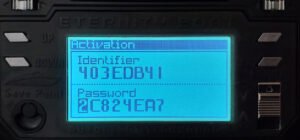
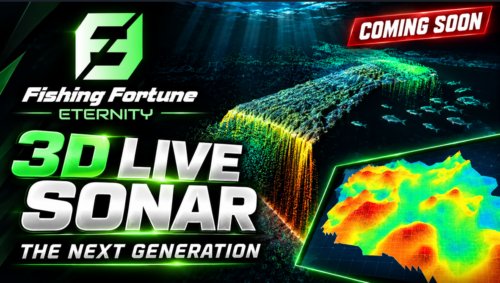
 MULTIVISION V3 COMIN SOON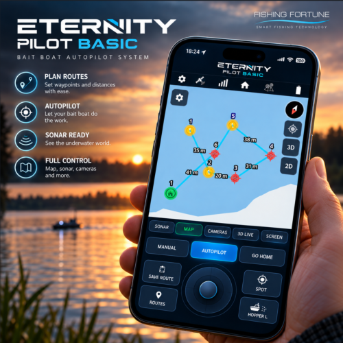
 GPS module ready for the Eternity GPS autopilot for 6 and 10 channel autopilots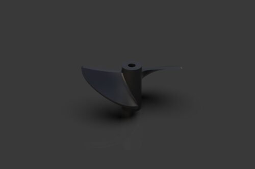
 Rc Boat Propeller